Indiana Statewide Orthoimagery Program Awarded
Beginning in 2005, Indiana has flown three state-wide orthophotography projects to capture aerial views of the entire state, allowing for linear and area measurements. These were flown 12-inch image resolution. Starting with this new program, 6-inch imagery will be the state standard.
The Sanborn Map Company, Inc. has been awarded the orthoimagery contract for the acquisition of new color digital orthophotography and ancillary products. “This statewide program supports a wide-range of projects around the state, benefiting economic development, transportation, natural resource management, and public safety,” Megan Compton, Indiana Geographic Information Officer said, “I am looking forward to seeing the results of this advanced imagery and its utilization throughout the state.” Partners in this program include the Indiana Office of Technology (IOT) and Indiana Department of Transportation (INDOT). Buy-up options (including 3-inch orthophotography and other ancillary products) will be available to Indiana cities, counties and other partners. The orthophotography program benefits Indiana by supporting over $1.7 billion in projects related to transportation, economic development, public safety, environmental management and other areas of interest. This high-quality imagery will be available to the public for viewing and download. To learn more about this program, visit https://www.in.gov/gis/indiana-imagery/ For more information contact: |

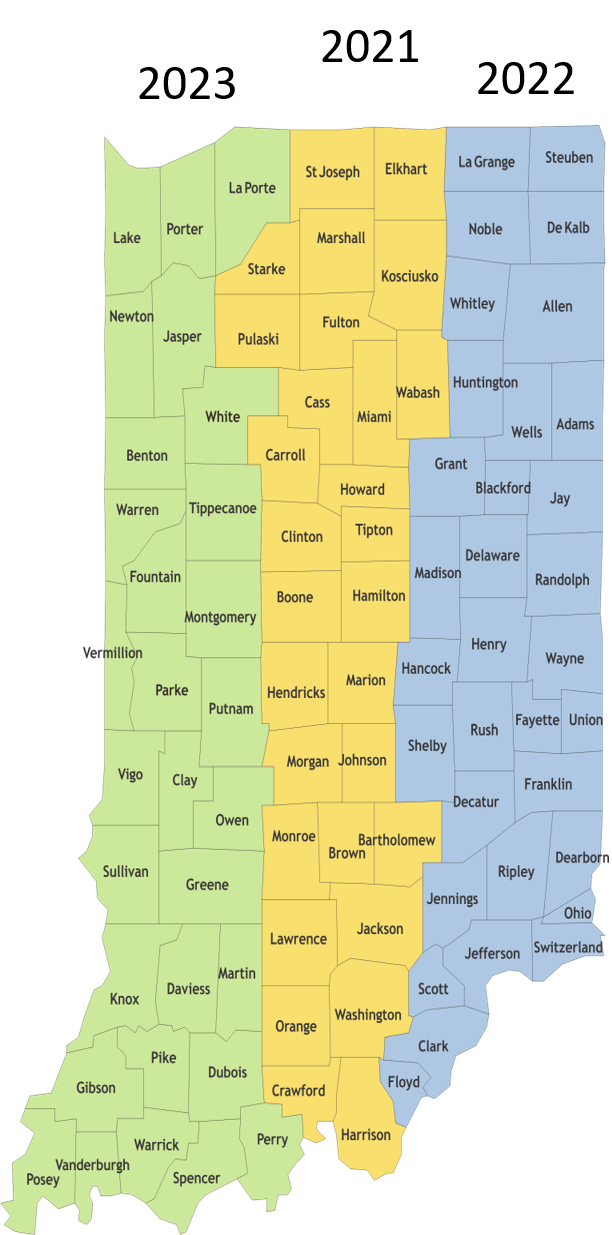 During 2021-2024, the entire state of Indiana will be flown, in three tiers, with central Indiana being flown first. With 6-inch pixel resolution, this allows the user to identify smaller ground features including such items as manhole covers, fire hydrants, utility poles and impervious services (e.g. roads and parking areas).